Sunday, July 21, 2024

Sketching an Alaska Cruise V


Hubbard Glacier
crayon and watercolour
©2024 Charlene Brown

This was the first of four places I had not seen on previous Alaska cruises in 2001 and 2005.

The Hubbard Glacier is North America's largest tidewater glacier. It flows 120 kilometres from Kluane National Park in the Yukon Territory of Canada through Wrangell-St. Elias National Park in Alaska.  It is 11 kilometres wide and over 100 metres above the waterline at its terminal face.

Allegedly, you can see Mt. Logan, the highest mountain in Canada, from our ship’s position in Disenchantment Bay.  However, most of the time we were there it was raining so hard you could barely see the face of the glacier, and the mountains above it were even less visible. 

Sunday, July 14, 2024

Sketching an Alaska Cruise IV


A picturesque glimpse into Skagway’s colourful past
crayon, ink and watercolour
©2024 Charlene Brown

When we returned from our drive up the Klondike Highway to Fraser BC, we stopped at the north end of Skagway.  There, a short hike up through the Gold Rush Cemetery brought us to a lovely little waterfall, Lower Reid Falls.

The waterfall is named after Frank H. Reid, the ‘good guy’ (by most accounts), in an historic gunfight in 1898. He shot the other participant, or ‘bad guy,’ a con man named Jefferson Randolf (Soapy) Smith, in “self-defence,” in the back (see what I’m doing here?)  Reid’s grave has an elaborate headstone, but Smith’s (just outside of the perimeter of the cemetery) tersely states his name, date of death and age, not even hinting at his side of the gunfight story.

Many of the graves are surrounded by intricately-carved fencing and sport colourful stories about the occupants’ advertised and actual occupations and circumstances of death.

Sunday, July 7, 2024

Sketching an Alaska Cruise III


Captain William Moore Bridge
crayon, ink and watercolour
©2024 Charlene Brown

This asymmetric single-pylon cable-stayed bridge is an impressive example of earthquake engineering. It spans the Moore Creek Gorge which flows along an active seismic fault line on the Klondike Highway about 27 km north of Skagway. To minimize potential bridge damage from earthquake movements along the fault line, the bridge was cantilevered, with anchors only at the south end.

Before the bridge was built in 1976, Whitehorse YT was only accessible from Skagway by the White Pass and Yukon Route railroad. Over the decades, heavy ore truck traffic weakened the bridge, and in 2019 it was replaced. The 1976 cable-stayed bridge was repurposed as a pedestrian viewpoint and historic site.

The view of the bridge shown in the painting above was based on photos taken when we stopped about a kilometre past it to look back at the highway.                                   

Friday, July 5, 2024

2024 Mid-Year Review

Skagway AK
crayon, watercolour and ink
©2019 Charlene Brown

I have been to Skagway twice before and have painted State St. several times, most recently in 2019. It looked much the same, with two cruise ships docked at the end of the main street on this year’s cruise.

I’ll continue ‘Sketching an Alaska Cruise’ this Sunday.  For today, here’s a quick mid-year review (yes, the year is in fact half over!) of how I’m coming along with my plans for 1150 Words, as set out at the beginning of this year

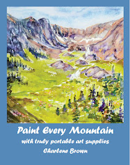
Paint Every Mountain: I finished and published this book about hiking and painting in mountains all over the world.

Creative Archaeology:  I have continued to build the series ‘Time Travel with a Bag of Crayons’ equipped with the same plein air painting kit I used for ‘Paint Every Mountain.’  The series, now in chronological order, will include some of the photos and sketches I accumulated in past archaeology-related travel with the Art Gallery of Greater Victoria and the travel study program at the University of Victoria.

Predictive Analytics This has evolved into a series of essays and illustrations of the increasingly drastic climate effects of the Anthropocene.

Sunday, June 30, 2024

Sketching an Alaska Cruise II


Mendenhall Glacier
crayon and watercolour
©2024 Charlene Brown

Our second port of call was Juneau, and a shore excursion to the Mendenhall Glacier. 

I was much more successful in “quickly capturing the essence” of this landscape, thanks to the Mendenhall Glacier Visitor Center provided by the US Forest Service. 

The sheltered, perfectly located presentation area took in the entire glacier and even included the top of spectacular Nugget Falls to the right of the glacier toe.  (I altered the perspective slightly to reflect the viewing angle from the upper part of the Visitor Center but, unlike my Ketchikan composition, only one viewpoint was required to see all the components of Mendenhall Glacier.)

The presentation area even included a long lectern-like table to hold notepads and sketchbooks!


Sunday, June 23, 2024

Sketching an Alaska Cruise


Ketchikan
crayon, ink and watercolour
©2024 Charlene Brown

In my book, ‘Paint Every Mountain’ I include some tips on quickly capturing the essence of a landscape with a few colourful ‘shapes’ using an easily carried painting kit ─ a bag of crayons. 

I don’t always follow these ‘essence’ tips, myself especially when I encounter a landscape with as many intriguing details and peculiarities as we found in Ketchikan AK, the first port of call on our recent cruise. 

Only partly cloudy the day we were there, Ketchikan is normally so wet that its annual rainfall is recorded in feet (about 13 of them)! The main street through town is set on pillars in the sea at the base of the lush mountainside. Side streets are so steep some are not ‘streets’ at all, but wooden staircases snaking up the rain-forested slopes. And Creek Street is in fact a creek, with moss-covered bridges and houses, artists’ studios and shops cantilevered over the torrent. 

Sunday, June 16, 2024

Paradigm shift on a greeting card


The Million Dollar View
Watercolour greeting card
©2024 Charlene Brown

For years I have tried to see and paint things differently, shifting away from realism toward abstraction.  Often the painting fights back, and I find myself adding picky details to what should have been the finished product.

I realized that’s what had happened here when I compared previous versions I had painted of roughly the same view.

This much-photographed scene was named ‘The Million Dollar View’ about a hundred years ago by the marketing department of the Canadian Pacific Railway, as it was the view from the (then CPR-owned) Banff Springs Hotel.  Sometimes pictures of the Million Dollar View included the hotel itself, as in the painting below one of the (slightly) more abstract ones I referred to above.  

Banff Springs, 2014
from the ’50 Shades of Orange’ chapter in Paint Every Mountain

Some time soon I am going to try painting pairs of greeting cards, one representational and one more abstract, at the same time.  Using the same colours. Maybe.

Sunday, June 9, 2024

This is not a waterfall


Bow Falls
watercolour greeting card
©2024 Charlene Brown


I was surprised when I looked for previous paintings of the (inaccurately named) Bow Falls that I might have written about on this blog, to find that there were none unless you consider the painting below, based on an aerial view of the Bow Valley. It includes the Bow Falls, among many other things.


This particular painting reminded me of the fact that this stretch of the Bow River consists of Class 5 rapids, not falls, stretching back toward the town of Banff almost half a kilometre.


Bow Valley
Watercolour
©1991 Charlene Brown

Sunday, June 2, 2024

Another ‘Street View’ greeting card


Climbing to Victoria Glacier
watercolour greeting card
©2024 Charlene Brown

Here’s another view that didn’t quite fit into the multi-viewpoint painting of the Plain of Six Glaciers  I mentioned last week.  On the extreme left of Climbing to Victoria Glacier, as well as the painting I wrote about last week, the ‘claws’ at the north end of Mt. Lefroy can be seen.

I must admit, even after hiking up to the glaciers a few times and seeing Mt. Lefroy from various angles, I hadn’t noticed this formation until my attention was drawn to it by the $1,667,500. sale of a Lawren Harris sketch that I wrote about in 2014. 

Sunday, May 26, 2024

My plan to produce a few more hand painted greeting cards


 Abbott’s Pass
watercolour greeting card
©2024 Charlene Brown

My semi-successful project to paint Christmas cards last year ─ only six turned out, and another was Photoshopped into an acceptable jpeg suitable for getting prints made  ̶   used up my supply of blank watercolour cards.

I decided to buy another six-pack and try painting Other Occasion, Congratulations, Get Well or whatever-came-along cards. Turns out they don’t sell six-packs or even ten-packs anymore.  I had to buy a set of 50!

The painting I used on my April 7 blogpost was the first painted card from this enormous supply, and is actually quite a bit smaller than it appears on the screen.

The greeting card painting above, Abbott’s Pass, shows one of the many individual Google Street Views I painted prior to combining several (not including this one) into a  multi-viewpoint picture of the Plain of Six Glaciers.  I’ll write about another one that didn’t ‘make the cut’ next week.

Sunday, May 19, 2024

Climate change and global decarbonization

I follow The Daily Difference Newsletterwhere the winners of the Bloomberg New Energy Finance (BNEF) Pioneers 2024 Awards were announced on May 3.

BNEF Pioneers is a program that identifies "game-changing innovations with the potential to accelerate global decarbonization and halt climate change.”

In 2024 the program focused on the following three areas, and other projects were allowed to apply in a Wild Card category:

·       Helping the deployment of clean energy
·       Decarbonizing the construction industry
·        Creating alternative fuels


Of the 240 companies from around the world that applied to be considered, 11 were selected to receive awards this year. 

I thought I was keeping up pretty well with climate change mitigation research   ̶  reading online, and in newspapers and magazines    ̶  and have written a book, Inventing the Future (shown above), as well as several blog posts on related topics

However, when I tried guessing what specific research would be included before reading the Daily Difference article, I barely came close on only four of them (identified with asterisks in the outline below). 

Although I agree with the aims of the first, second, and fourth of these project categories, I remain somewhat dubious about the objectives of the third. 

1. Deployment of clean energy:

  •  envelio - intelligent power grid design
  • PVcase - PV site selection and design
  • TS Conductor - high performance conductors for modern power grids

2. Decarbonizing the construction industry:

3. Creating alternative fuels:

  •  CoverCress - advanced breeding and gene editing to create climate-smart winter-growth cover crop that can be refined to produce ethanol.*
  • XFuel - conversion technology producing waste-derived bio synthetic fuel.*

4. Wild Cards – outside these categories:

  • ElementZero - converts metal ores to pure metal with zero carbon emissions
  • Li-Metal  creating scalable technologies for next-generation batteries
  • NatureMetrics  scalable nature intelligence & biodiversity metrics powered by eDNA

Climate change and decarbonization research is a much wider field than I imagined.  And it’s growing exponentially!

Sunday, May 12, 2024

Reducing the food component of your carbon footprint


 Mt. Meager
w
atercolour and crayon
©2020 Charlene Brown

A Canada/UKstudy published in Nature Food, a peer-reviewed online journal covering research, reviews and comment on all aspects of food production, processing, distribution and consumption, outlined the environmental and nutritional benefits of reducing consumption of red meats (significant) and dairy products (not so much).

They found that replacing half of the red meat in the average Canadian diet with plant proteins would shrink an individual’s food-related carbon footprint by a striking 25%. But replacing half the dairy products with plant alternatives only erased 5% of dietary emissions.

The relatively small size of the environmental gains for dairy substitutes were put into perspective when they were weighed against some of the nutritional losses which would result from such a shift.  

The most striking figure was that a 50% dairy replacement would lead to a 14% increase in the number of people experiencing a calcium deficit in Canada—an ingredient that is critical for the growth of healthy muscles and bones.

The study produced much more detail, and many more measurements, ratios, and percentages, but I am only mentioning the most easily interpreted results   ̶  coincidentally, the results which lead to dietary recommendations I agree with.  To a certain extent, I'm already following these recommendations in an effort to reduce my own carbon footprint. It’s not difficult to eat red meat less frequently, but I’d hate to try to live without cheese.

I’ve used the painting of Mt. Meager to illustrate this post because it seems to be my only painting that includes livestock. They started out as horses (by no mean a significant part of the Canadian diet) but for now they are going to be cattle.

Sunday, May 5, 2024

Google Street View − the ultimate multi-viewpoint presentation!

Plain of Six Glaciers above Lake Louise
Watercolour, crayon and computer
©2024 Charlene Brown

In the late 1950s when I was in high school, it was our custom to hike to the Plain of Six Glaciers after work on the August long weekend – a distance of about 5 km with an elevation gain of about 500 m. After camping overnight on the Plain of Six Glaciers, we would continue up a much steeper, more rugged trail along the crest of a moraine to a ‘corn snow’ slope at the north end of Victoria Glacier. Carrying our ski equipment! 

Most of us had only enough stamina for one or two careful runs down the slope, stopping well short of the precipitous drop-off for which Mt. Victoria is famous.  The (barely) skiable part of the glacier is on the right edge of the painting above.   

To my amazement, I recently discovered that the trail can be found on Google Street View – I can’t believe somebody got a Google camera up there!

Have a look at this link or this one  Swivel the camera at each location and you’ll see a few of the many shots I used to produce the telescoped and manipulated composition above.


Sunday, April 28, 2024

More viewpoints are more fun

Middle Spring on Sulphur Mountain
watercolour and ink
©1992 Charlene Brown

A month ago I used a recent painting of the Middle Spring to illustrate a blog post about a hypothetical self-sustaining CO2 removal loop

The painting on the left, of the same location, was done back in the day when I used to limit myself to one viewpoint.  I prefer the 2024 version -- and paintings with more content, in general.

These additional viewpoints can be achieved by rotating your field of vision or moving to a slightly different vantage point. Or both.

In my latest book, Paint Every Mountain,  I devote a whole chapter to ‘Moving Around, Combining and Superimposing for a Better Composition’ and next week I'll write about the ultimate multi-viewpoint presentation.


Sunday, April 21, 2024

Flying to Vancouver


UBC from a Floatplane
Watercolour and crayon
©2024 Charlene Brown

It used to be that harbour-to-harbour flights from Victoria to Vancouver were routed directly over the terminal at YVR and across Point Grey about three kilometres east of the University of British Columbia. 

But floatplanes are now required to fly over water as much as possible. This safer route serendipitously results in a much more interesting view of UBC, whereby much of the campus, the downtown core of Vancouver, and Mount Baker can all be lined up in one reference photo. 

Well, three photos, actually, shot in rapid succession, because one of the airplane’s propellors, which was right beside me, cut out a slice of each shot.  

Sunday, April 14, 2024

Another illustration for The Grand Tour of 2000

A view of the garden at Chateau Hautefort
Watercolour and crayon
©2024 Charlene Brown

Back in 2020 when we couldn’t go anywhere or do anything, I wasn’t getting out to paint much.  So, I wrote a series of blog posts expanding on the Christmas letters I had written and illustrated since 1990. 

In 2000 our activities had included a two-month Grand Tour of Europe   ̶    resulting in a longish Christmas letter that year.

Here is a thumbnail illustration of that letter 

A couple of months ago, I decided to write a two-part version of that Grand Tour on Medium, an online publication that actually pays writers and illustrators for stories.

 The second part was a little short of paintings, so I added Chateau Hautefort to the mix.  

Here's my description of our day there:

In the second week of June, we were in the Périgord region of France, where we toured the Chateau Hautefort. The estate was a real treat — acres of Cedars of Lebanon and geometric and filigree-sculptured boxwood. We probably should have stayed outside in that wonderful garden.  But it was threatening rain most of the time we were there, so in we went. The inside was mainly spiral staircases and furniture they didn’t encourage you to sit on. But you do get a nice look at the geometry of the gardens from the tops of the turrets.

Sunday, April 7, 2024

Solving two Anthropocene problems with a self-sustaining loop


The cave and outflow from the Middle Springs
watercolour and crayon
©2024 Charlene Brown

Another proposed combination of technologies may result in a synergistic cost saving by creating a self-sustaining loop.  CO2 removed from the atmosphere by Direct Air Capture (DAC) is stored in deep, hot aquifers.  Heat brought to the surface could then be used to power the DAC process.  Thus the excess CO2  itself could reduce the high cost of removing it from the atmosphere. 
Like the nearby geothermal source I wrote about eight years ago, however, this particular hot spring would not be a suitable location for such a self-sustaining loop.  


Sunday, March 31, 2024

Another page for my Time Travel book


San Gimignano towers, Tuscany, Italy
watercolour monotype 1/1
©1988 Doris Livingstone

I’ve been to this medieval walled city, where 'skyscrapers' were invented, twice.  The first time was in 1988 when I was visiting my sister during a print-making workshop she was attending in Florence.  She was learning to make monotypes such as San Gimignano, above, which I love, so I have made this one exception to my watercolour-and-crayon procedure for illustrations in my Time Travel book. 

I’d never heard of San Gimignano, but she promised me that the 800-year-old ‘skyscrapers’ – apparently built by rival families trying to out-do each other ­­over a period of years beginning in 1199 – were definitely worth seeing, and it was easy to get there on a local bus.  She was right on both counts and we had a great day, with the place practically to ourselves.


It was quite a different story in 2000 with my husband on our Retirement Grand Tour, because an amazing number of people seemed to have found out about the place since 1988, and we had to deal with a lot of world class competitive parking professionals. Even under those circumstances it was well worth the effort, starting with our first glimpse of the  unforgettable skyline as we made our way from the distant spot on the highway where we’d left the car through climbing up to the city’s hilltop setting and exploring the stonework and architecture.


Here I am recovering from the effort


Sunday, March 24, 2024

One more for the Bucket List in my Paint Every Mountain book

Torres del Paine National Park
watercolour and crayon
©2024  Charlene Brown

Torres del Paine National Park is a hiker’s paradise – its most famous hike being the demanding W Trek up and down the park’s valleys to see its most famous sights. 

If I ever do get to this magical place, I am unlikely to try the entire 50 kilometre length of this route – which takes the shape of a “W.” Hence the name.

I missed my chance to fly into Torres del Paine when I was on a cruise to South America and Antarctica in 2002 – mainly because this particular 6-hour shore excursion cost almost $1000! With no guarantee of a landing when you got there!

Instead I computer-painted an outline of several mountains in the range combined with a star chart from the Southern Sky astronomy lesson we’d had on-board our darkened ship earlier in the cruise.


Southern constellations, 2002
computer painting


Sunday, March 17, 2024

Surfrider Foundation Canada


Vancouver Island Surf (reference used was composite of several photographs)
watercolour and crayon
©2024 Charlene Brown

Canada’s pristine coastline (at 202,000 kilometres, the longest in the world) has long been a source of wonder and inspiration, attracting adventurers and nature enthusiasts from all over the world. Among the many activities that draw people to Canada’s coasts, particularly the west coast of Vancouver Island, surfing has become a huge draw in recent years.

Because of the potential impact of thousands of surfers on the landscape, marine biodiversity, and indigenous cultural heritage, Surfrider Foundation Canada was formed.  Their purpose is to ensure that the delicate balance between coastal recreation and conservation efforts is maintained and the oceans and beaches they love are protected.

SFC activities have expanded to include leadership in pollution prevention, coastal protection, and environmental awareness training. Current priorities include plastics reduction, environmental monitoring, coastal clean-up campaigns, as well as container spill response and debris mitigation.


Sunday, March 10, 2024

Another page for my Time Travel book


Mine shuttle at Bankhead
watercolour and crayon
©2024 Charlene Brown

Bankhead, a ghost town near Lake Minnewanka in Banff National Park, was a coal mining town that flourished at the turn of the twentieth century.

Little remains but some building foundations, the steps up to the Catholic church and part of the mine train shown in this painting.

When the mine closed in the 1920s, most of the people and several buildings were moved into nearby Banff and Calgary.


Bankhead, as it was in 1910
computer painting
©2005 Charlene Brown


Sunday, March 3, 2024

Another page for my Time Travel book

Great Hypostyle Hall, Karnak Temple, Egypt
watercolour and crayon
©2024 Charlene Brown

The Karnak Temple is located in the ancient city of Thebes (now called Luxor) in Egypt.  It is thought to be the largest temple complex ever constructed anywhere in the world.

The Hypostyle Hall was built by Pharaoh Seti I and his son Rameses II. The columns represent the primeval papyrus swamp in which Atum, a self-created deity, arose from the waters of Nun at the beginning of creation.

The Karnak Temple was one of the many Eqyptian archaeological sites we visited as part of the University of Victoria travel study program in 2008.  I wrote about several of these fantastic places when I started this blog the following year, but for some reason the only mention of Karnak was in this blog post  and it was pretty brief.


Sunday, February 25, 2024

Another Bucket List Painting


 Milford Sound / Piopiotahi
watercolour and crayon
©2024 Charlene Brown

This sound, on the west coast of the South Island of New Zealand, is one of roughly 90 places to have been given a dual name as part a 1998 Treaty of Waitangi settlement recognizing the significance of the fiord to both Māori and non-indigenous (primarily European-descended) New Zealanders. This name consists of both the Māori and European names used together as a single name, instead of as interchangeable alternate names.

This view includes some of the same mountains (from almost the exact opposite direction) that were in the Streetview I painted  when the Virtual Paintout was in New Zealand 


North of Glenorchy, Otago
Watercolour, crayon and CP
©2011 Charlene Brown

Sunday, February 18, 2024

South Pacific possibilities for the Bucket List chapter of my Paint Every Mountain book


Mount Otemanu
watercolour and crayon
©2024 Charlene Brown

This extinct volcano,  which rises to 727 metres, is the highest peak on Bora Bora, a small island northwest of Tahiti in French Polynesia.

I’d like to see some other mountainous islands in French Polynesia and I’ve found that most South Pacific cruises feature some combination of these and (conveniently) sail out of another Bucket List destination I'll talk about next week – New Zealand 

Also on my Bucket List is Easter Island. But this turns out to be one of those ‘can’t get there from here’ spots, and is described as one of the most isolated places in the world. 

It’s a long way from French Polynesia and in fact belongs to Chile. So now I’m trying to figure out how to combine it with places in Chile which are also on my Bucket List

Moai, Easter Island
watercolour and crayon
©2016 Charlene Brown


Sunday, February 11, 2024

Springtime in the Rockies


Early crocus in the Bow Valley
watercolour and crayon
©2023 Charlene Brown

Although the crocus, and dozens of other bulbs are up and shrubs and trees are starting to blossom here in Victoria, this painting is not showing the current conditions at the Banff Springs Golf Course.

I painted it several weeks ago in the dead of winter simply because I needed some Springtime in the Rockies that day. In fact, crocus don’t usually get through the snow until late April, sometimes May, in Banff

Sunday, February 4, 2024

Are we reaching a tipping point in global heating?


Alberta Wildfire
watercolour
©2023 Charlene Brown

The National Centers for Environmental Information in the American National Oceanic and Atmospheric Administration provides environmental data, products, and services covering the depths of the ocean to the surface of the sun.

NOAA Chief Scientist Dr. Sarah Kapnick said that the findings of their 2023 climate analysis were astounding. “Not only was 2023 the warmest year in NOAA’s 174-year climate record — it was the warmest by far.”

The impacts of climate change are happening here and now, like extreme weather events that are becoming more frequent and more severe. There were many extreme weather events in 2023, along with record-low sea ice coverage and catastrophic wildfires. In Canada, 45.7 million acres burned, 2.6 times the previous record.

One of the confounding factors making forecasting the future more difficult, which I wrote about three years ago is the phenomenon of tipping points.  These are actions of a complex system which has become unstable.

Are we reaching a tipping point in global heating?

Read Decimation doesn’t begin to describe what happened in Lytton

Or have we already tipped?

Sunday, January 28, 2024

How climate change worsens heatwaves, droughts, wildfires and floods*


1. Hotter, longer heatwaves:   The intense heatwaves that hit southern Europe and the southern US and Mexico in July 2023 would have been "virtually impossible" without human-caused climate change.  And these events are no longer rare. If global warming reaches 2C above the pre-industrial period these events are expected to happen every two to five years.

As well as happening more frequently, heatwaves are becoming longer and more intense in many places.

This can happen as a result of heat domes, which are areas of high pressure where hot air is pushed down and trapped in place, causing temperatures to soar over large areas.  One theory suggests higher temperatures in the Arctic (which has warmed more than four times faster than the global average) are causing the jet stream to slow, increasing the likelihood of heat domes.

2. Longer droughts:  Longer and more intense heatwaves can worsen droughts by drying out soil. This makes the air above warm up more quickly, leading to more intense heat.  Increased demand for water from humans, especially farmers, in hot weather puts even more stress on the water supply.

Climate change has made droughts at least 100 times more likely.

3. More fuel for wildfires:  Climate change is making the weather conditions needed for wildfires to spread more likely. Extreme and long-lasting heat draws more and more moisture out of the ground and vegetation. These tinder-dry conditions provide fuel for fires, which can spread at an incredible speed, particularly if winds are strong.

Rising temperatures may also increase the likelihood of lightning in the world's northernmost forests, increasing the risk of fires. Canada experienced by far its  worst wildfire season on record in 2023, with around 18 million hectares (45 million acres) burned.

Climate change more than doubled the likelihood of the extreme "fire weather" conditions in eastern Canada that allowed the fires to spread, Extreme wildfires are projected to become more frequent and intense in future across the globe. This is due to the combined effects of shifting land use and climate change.

4. More extreme rain:  For every 1C rise in average temperature, the atmosphere can hold about 7% more moisture. The heavy rainfall was made as much as 50 times more likely by climate change, Globally, the frequency and intensity of heavy rainfall events has increased over most land regions due to human activity. And heavy precipitation will generally become more frequent and intense with further warming,


*Outline of an article by Mark Poynting and Esme Stallard, BBC News Climate & Science


Saturday, January 27, 2024

Impressionist version of Doughnut Economics in a Circular Economy


The Doughnut
watercolour and crayon
©2023 Charlene Brown

The circular economy represents a shift from a 'take-make-waste' linear economy to an economic system based on the reuse and regeneration of materials or products, especially as a means of continuing production in a sustainable or environmentally friendly way, minimizing waste.

Doughnut economics extends this transformation to encompass a double shift – from a linear economy to a regenerative and distributed economy that looks at sustainable development across a number of different vectors.

The Doughnut is the core concept at the heart of Doughnut Economics.  And here’s a more readable explanation of it.

First published in 2012 in an Oxfam report by Kate Raworth, The Doughnut is a guide for human prosperity in the 21st century, with the aim of meeting the needs of all people within the means of the living planet.

The Doughnut consists of two concentric rings: a social foundation, to ensure that no one is left falling short on life’s essentials, and an ecological ceiling, to ensure that humanity does not collectively overshoot the planetary boundaries that protect Earth's life-supporting systems. Between these two sets of boundaries lies a doughnut-shaped space that is both ecologically safe and socially just: a space in which humanity can thrive.