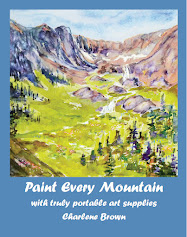
Watercolour and crayon
©2017 Charlene Brown
It’s true – the grass is greener on the American side of the Strait of Juan de
Fuca. This is because they get much more rain than we do. In fact Victoria is
said to be in the ‘rain shadow’ of the Olympic Mountains. Moist Pacific air dumps
everything it’s got on the area I’ve painted (represented by the biggest red
cloud on the weather map on the right) before it gets to Victoria.
They don’t have actual hurricanes – as the name of the ridge and its appearance on the weather map would imply – but they get a lot of rain. And anywhere from 30 to 60 feet of snow every year!
A bunch of us from the Esquimalt racing group went over for an afternoon of hiking along Hurricane Ridge last weekend and we had a great day, with high cloud, almost no rain at all, and just enough of a breeze to cool the July day down to perfect!
The spruce trees are bluer on the other side too…